Earth Science (and related natural sciences)...

Table of Contents:
NOAA provides links thru a "WINDandSEA" website
to over 750 government and educational sites that contain relevant
information on oceanic and atmospheric sciences. From this site,
links can be made to other NOAA sites as well as current
WEATHER information. An excellent
EARTH SCIENCE resource. Click on the
icon below to go directly to NOAA's home page otherwise, click on the
url below for WINDandSEA.

http://www.lib.noaa.gov
Would you like to take your students on an
interactive investigation of Antarctica? This multi-week highly
acclaimed online educational site called BLUE
ICE ANTARCTICA is geared for the middle school student.
http://www.onlineclass.com/BI/blueice.html
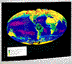
The EARTH and MOON VIEWER site
displays outstanding views of the Earth in particular. Would you like
to see a topographic map of the planet
with a real time image depicting where its light out (that updates
every minute!)? These maps are interactive in the sense that you can
zoom in by selecting latitude and longitude data. You can also see
weather satellite images and composite
maps.
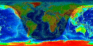
http://www.fourmilab.ch/earthview/vplanet.html
GREENPEACE has a website that provides
information on all kinds of
ENVIRONMENTAL issues. Students of EARTH
SCIENCE, BIOLOGY, and ENVIRONMENTAL SCIENCE will find this site
informative. This site can also be used as a starting point for
critical analysis of the environmental issues that Greenpeace is
involved with. While students should be encouraged to visit this
site, they should also be encouraged to investigate all claims made
by Greenpeace.
http://www.greenpeace.org/index.shtml
NASA's Observatorium "Learning
without Touching" website is an introduction to Remote Sensing.
Several links introduce the reader to Remote Sensing, apply remote
sensing to satellite technology, and offer applications from
Archaeology to Astronomy. Links to other remote sensing sites can be
accessed from this site.
http://observe.ivv.nasa.gov/nasa/exhibits/learning/learning_0.html
To share an introductory thought
as it appears on this site: NASA's Observatorium is a public access
site for Earth and space data. We have pictures of the Earth,
planets, stars, and other cool stuff, as well as the stories behind
those images. Specifically, links to various earth science topics can
be accessed from this site. These include Satellite Images, Plate
Tectonics info, as well as physical science topics such as
Centrifugal Force.
http://observe.ivv.nasa.gov/nasa/core.shtml
The NASA Mission to Planet Earth site provides
links to an IMAGE gallery depicting a variety of the Earth's systems.
Links to information specifically appropriate for students can be
found here, as well as information about NASA and the study of the
Earth's major systems.
http://www.hq.nasa.gov/office/mtpe/
The Real-Time Science Data Access Page offers access to data
covering the following topics: Astronomy-Images of the Sun, Images of
the Moon, Mars, the Earth, satellite locators, space shuttle locator.
Meteorology-Live Weather Cams, Jet Stream Analysis, Tropical Storms,
latest surface, satellite and radar images for the U.S. and the
World. Oceanograpy-El Nino Watch, TOPEX sst's, wave heights, Gulf
Stream. Geology-U.S. Earthquakes, Volcano data, California
Seismograph. There are also links to Ozone data, AVHRR Images,
Climate data, and images of the Universe.
http://www.math.montana.edu/~tslater/real-time/
Geographic Information Systems Links
ESRI, Environmental Systems Research Institute
has developed ArcView GIS, a tool for use among professionals in the
field as well as for educators in the classroom. Learn GIS and your
students can be exposed to software that can enable them to better
understand their physical world all the while learning a software
tool that could lead to future job opportunities. The first link
below is to ESRI's main web page. This page includes links to the
variety of products that they make available as well as links
appropriate for all users of this software.
The second link is specific to K-12 educators and librarians.
This page provides tutorials for using ArcView GIS as well as teacher
ready lessons designed to introduce this powerful software to your
students. The software comes with a wealth of data, however, updates,
such as recent earthquake data are available for download from this
site. Much of the data is available for both PC and Macintosh
platforms. Many other sites provide GIS data. Check back here for new
links over time to add to your GIS library.
http://www.esri.com
http://www.esri.com/industries/k-12/material.html